Subject: Arizona
Period: 1905 (dated)
Publication:
Color: Printed Color
Size:
16.8 x 20 inches
42.7 x 50.8 cm
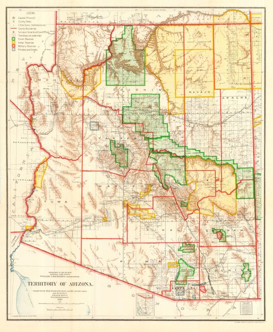
A colorful and fascinating map that provides a detailed look at Arizona Territory just seven years before statehood. The extent of nine Indian reservations and three military reservations, including Fort Apache, and numerous National Forest Reserves are clearly shown in different colors. Private claims, confirmed and unconfirmed, are outlined in red. The Grand Canyon Forest Reserve is shown. Brown hachured mountainous areas and blue waterways combine to provide great visual impact. Details include watershed, mountains, railroads, wagon roads, private claims, unsurveyed townships, etc. This map initially appears identical to the 1903, but closer study shows subtle but important differences.
References:
Condition: A+
Folding, as issued. A clean, bright example with perfect color. Short tear at binding trim, closed on verso with archival tape and a little misfolding in a small area at binding trim.