Subject: Western United States
Period: 1860 (circa)
Publication: ASP Military Affairs, Vol. VI, No 654-A
Color: Hand Color
Size:
17.8 x 18.5 inches
45.2 x 47 cm
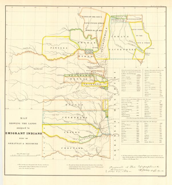
This attractive map was originally published in 1836 in the "Report of the Dragoons under command of Colonel Henry Dodge to the Rocky Mts. during the Summer of 1835," and because of its scarcity and importance, was reissued in American State Papers c. 1860. The map covers the region of present day Iowa, Nebraska, Kansas and Oklahoma. The tribal lands are outlined in color. An inset provides tabulations of the numbers of Indians and a listing of estimated acres of land assigned to these Tribes. While it shows the Santa Fe Road, the route of Col. Dodge is not depicted. The map is based on the 1836 map prepared by Lt. Washington Hood. Wheat calls it "an important historical map." It documents an ugly phase of American history during the first half of the 19th century when Indian tribes were forced to migrate to the areas shown.
References: Claussen & Friis #127; Wagner-Camp #63; Wheat [TMW] #412
Condition: A
Lovely coloring and impression. Issued folding, this example pressed and backed with archival tissue. A trace of light offsetting, else fine.