Catalog Archive
Auction 113, Lot 186

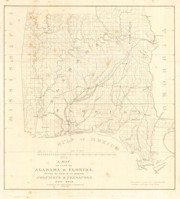
"No. 1 A Map of Part of Alabama & Florida shewing the route of the proposed Columbus & Pensacola Rail Road", U.S. Corps of Engineers

Subject: Southern United States

Period: 1836 (dated)

Publication: HR Doc. No. 176

Color: Black & White

Size:
20.5 x 22 inches
52.1 x 55.9 cm
Download High Resolution Image
(or just click on image to launch the Zoom viewer)

An early and notable railroad map of parts of southern Alabama and western Florida showing considerable detail. Notes the route of the railroad from Pensacola to Montezuma and on to Columbus. Also details the proposed road from Appalachicola to Marrianna. Shows numerous wagon roads and names numerous towns and forts. From the report by Major James Duncan Graham, Feb. 6th 1836. The map was drawn by Wm. R. Palmer chiefly from the original surveys in the General Land Office in Washington, D.C.

References: Clausen & Friis #125; Modelski (Railroads) #388.

Condition: B

Issued folding, now backed with archival tissue. Occasional scattered foxing.

Estimate: $140 - $180

Sold for: $130

Closed on 12/7/2005

Archived