Subject: North America - Wall Map
Period: 1856 (dated)
Publication:
Color: Hand Color
Size:
59.5 x 59.5 inches
151.1 x 151.1 cm
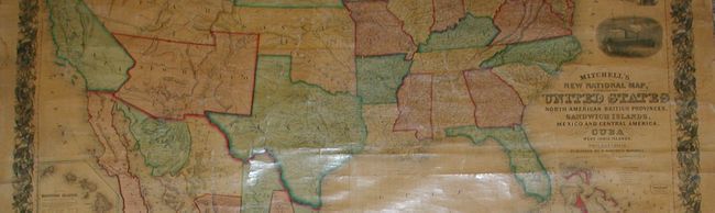
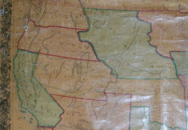
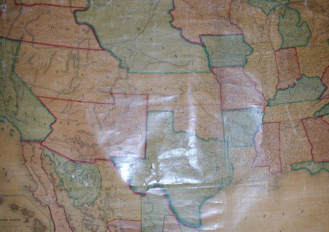
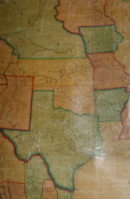
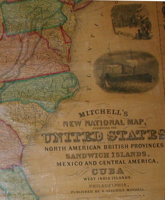
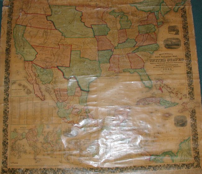
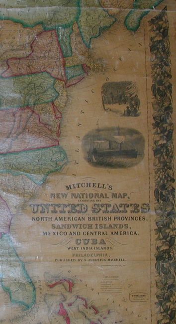
This is a very nice example of the first edition of Mitchell's "New" map of the United States. The map shows the entire U.S. with some fascinating territorial borders in the West. Washington and Oregon extend to Nebraska Territory at the Continental Divide. Along the Canadian boundary, Nebraska Territory continues eastward to a large Minnesota Territory at the Missouri River. The huge territory of Utah encompasses all of Nevada and most of Colorado. New Mexico Territory includes all of Arizona, the southern tip of Nevada and a small portion of Colorado. Finally, a huge Kansas Territory shares its western border with Utah. Large inset maps of the Sandwich Islands, the world on Mercator's Projection, and the world in hemispheres. Several finely engraved vignettes including the "Clipper Ship Flying Cloud," and an "American Steamship Crossing the Atlantic." The map is very detailed with hundreds of place names, plus roads, villages, railroads, ports, etc. A table at bottom gives the 1850 population for many U.S. cities. A small table gives the population of numerous Canadian cities from the 1851 census. All surrounded by a wide decorative border. An exceptional map that is in remarkable original condition. Top roller missing, lower roller attached.
References: Rumsey #2292; Wheat [TMW] #896.
Condition: B
Edges a little rough in places, also in upper map, especially along top margin. Puncture with small loss at right. Chip at upper right edge into decorative border. Varnish is quite clear with little darkening. Marginal stains top and right side.