Catalog Archive
Auction 112, Lot 711

"A Geographical Chart of the Cape of Good Hope, exhibiting as well the Settlements of the Dutch, as the Stations of the Hottentots, delineated from Actual Observation, and from the Information of the Inhabitants", Sparrmans, Andrew

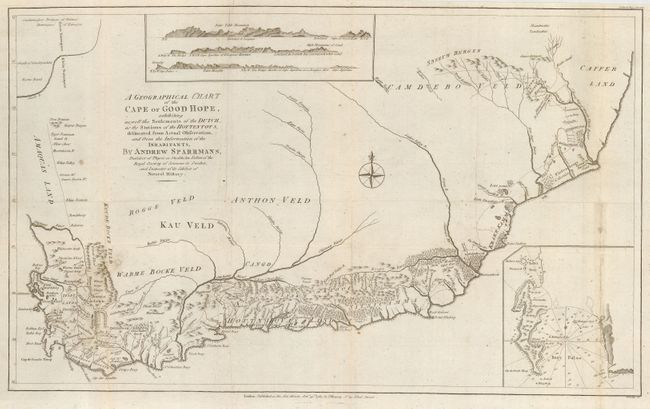
Subject: Southern Africa

Period: 1785 (dated)

Publication: Political Magazine

Color: Black & White

Size:
21 x 13 inches
53.3 x 33 cm
Download High Resolution Image
(or just click on image to launch the Zoom viewer)

Sparrmans' map is a milestone in the history of South African cartography. While the information outside the settled regions of the Cape are less reliable than that of the Dutch settlements, the map is a great improvement on its predecessors. Inset at bottom right is a map of False Bay and at top are three coastal views.

Sparrmans, a Swedish naturalist and former student of Carl Linnaeus, arrived in the Cape Colony early in 1772 intent on studying the natural history of the region. In the fall of that year he joined Captain Cook's second great voyage and served as the expedition's natural historian; returning to the Cape in 1775. After his return he made an expedition into the region represented on this map and eventually published an account of his travels in 1785.

References: Jolly POL-93; Norwich #223.

Condition: B

Old paper flaw at lower right and a bit of minor soil.

Estimate: $300 - $350

Sold for: $160

Closed on 9/28/2005

Archived