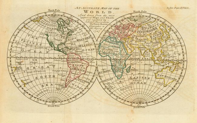
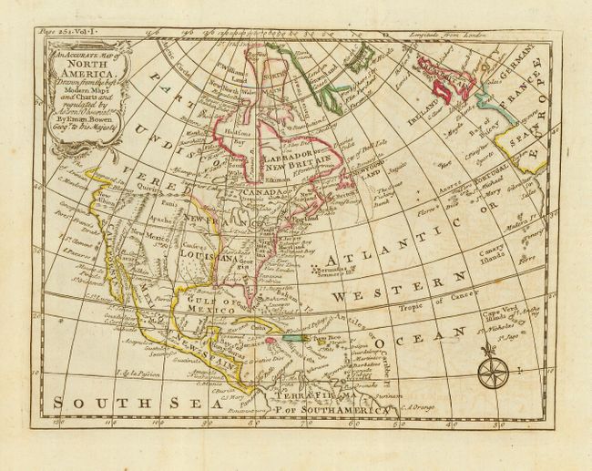
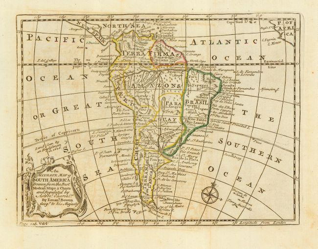
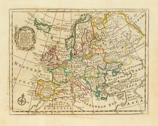
Subject: World & Continents
Period: 1747 (dated)
Publication: A Compleat System of Geography
Color: Hand Color
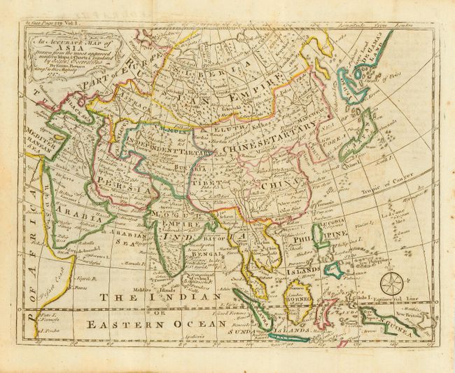
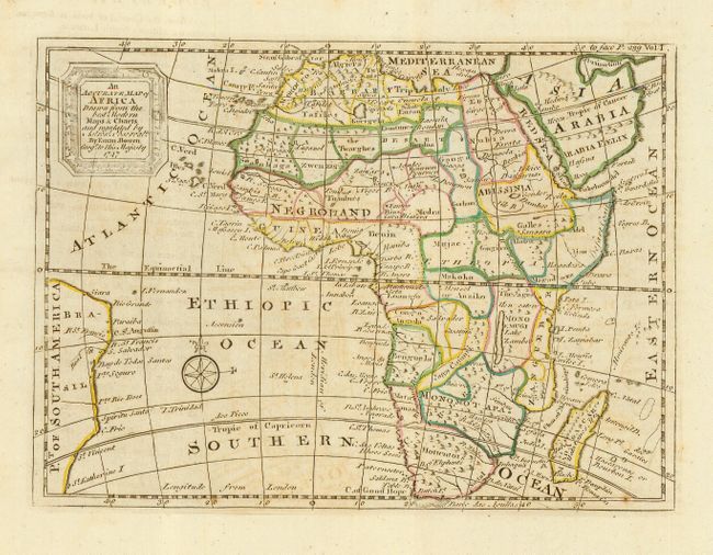
Set of six matching maps comprising the world and continents. Set includes: 1) An Accurate Map of the World (11 x 6"); 2) An Accurate Map of North America ( 8 x 6"); 3) An Accurate Map of South America ( 8 x 6"); 4) An Accurate Map of Europe ( 8 x 6"); 5) An Accurate Map of Asia ( 9 x 6.8"); and 6) An Accurate Map of Africa (8 x 6"). In the world map only the eastern shoreline of New Zealand is mapped, Australia (New Holland) is not mapped along the north eastern quadrant and Van Diemens Land is still attached. In the Americas the entire western part of Canada is labeled Parts Undiscovered, the Colorado correctly empties in to the Gulf of Cortez (Vermilion Sea), spurious mountain ranges run throughout the West, and New Albion and Quivera are located. Tierra del Fuego is represented as being fully insular from the southern Terra Magellanica. The map of Africa has no blank areas but plenty of speculative cartography. The map of Asia has a most interesting depiction of Japan with an insular Yedso and De Gama's Land to the east and an archipelago. All with compass roses and fancy title cartouches.
References: Asia, Yeo #136.
Condition: B
Excellent impressions on fine hand laid paper. Original coloring in outline. All with occasional offsetting, else very good. Two maps with insignificant holes: one very small hole in world in blank ocean, Asia with an even smaller hole in Korea.