Subject: World & Continents
Period: 1729 (circa)
Publication: Introductio in Universam Geographicam…
Color: Hand Color
Size:
10 x 8 inches
25.4 x 20.3 cm
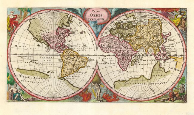
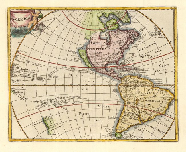
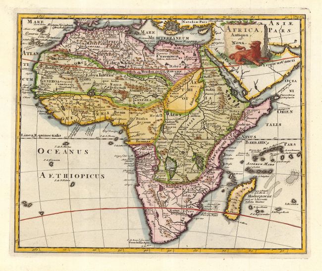
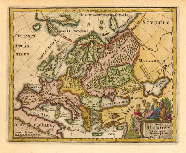
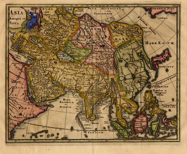
Nice set of maps each finely engraved and embellished with title cartouches. The world map depicts mid-seventeenth century geography with the partial shorelines of a large Terra Australis Incognita and the rudimentary beginning of an unnamed Australian continent. In North America, California is a peninsula with Quivera and Anian expanding the continent too far west. The map is supported on the shoulders of Atlas and surrounded by allegorical representation of the continents; interestingly females represent America and Europe at top, and males represent Asia and Africa at bottom. The map of the Americas is more up-to-date with the island of California and the western coastline of New Zealand. The map of Africa shows typical seventeenth century cartography with the Nile rising from twin lakes below the equator and spurious details in the interior. The map of Europe shows its ancient divisions. The Asian map is truncated in the Far East with a kite-shaped Japan. World map measures 12 x 6.3"; others approximately 10.3 x 8".
References: World, Shirley #586; Americas, McLaughlin #25-5; Asia, Yeo #26.
Condition: A
Europe and Asia slightly toned. A few tiny scattered worm holes, but overall very good with attractive later color.