Subject: Continents
Period: 1703 (published)
Publication: Cosmography in four books
Color: Hand Color
Size:
16.5 x 14 inches
41.9 x 35.6 cm
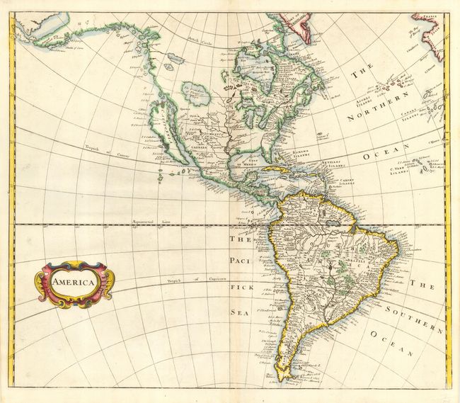
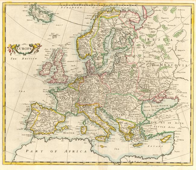
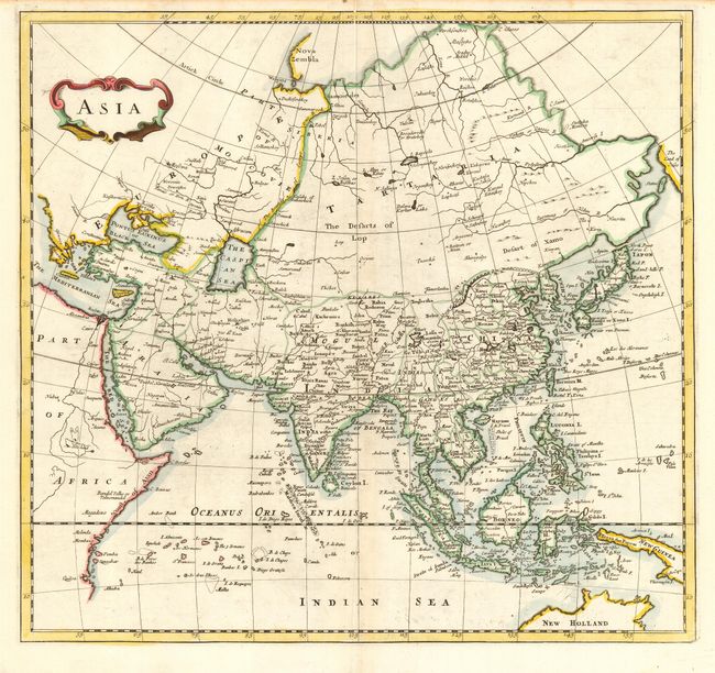
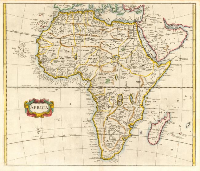
Matched set of continental maps each finely engraved, filled with place names and adorned with strapwork title cartouches. The map of the Americas features the island of California on the Sanson model. The western coastline stretches far to the north with several inventive place names along the coastline. In the West is a huge lake labeled The Great Lake of Thongo or Thoya. Parime Lake is prominently shown in South America. The map of Europe extends to include Iceland and is well detailed. The map of Asia depicts the northern region projecting too far east with the Land of Jesso extending off the map. The map of Africa shows the large lakes, Zaire and Zaflan, just below the equator. But instead of spawning the Nile River, the Zebee River flows into them from the north while the Zaire, Zembeze and several other rivers flows out to the west and south. Numerous kingdoms are located throughout.
References: Americas, McLaughlin #154.
Condition: A
Bit of very minor soil and a few extraneous creases, else fine.