Catalog Archive
Auction 112, Lot 141

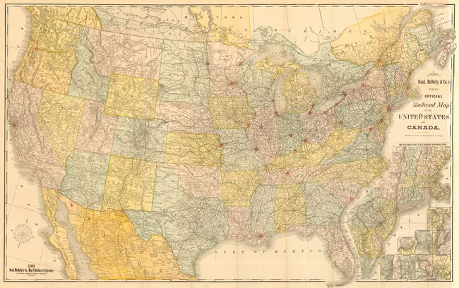
"New Official Railroad Map of the United States and Canada", Rand McNally & Co.
Subject: United States

Period: 1885 (dated)

Publication:

Color: Printed Color

Size:
42.5 x 26.5 inches
108 x 67.3 cm
Download High Resolution Image
(or just click on image to launch the Zoom viewer)

Very large, colorful map with terrific railroad detail along with wagon roads, watershed, cities and villages, etc. Insets "Map of Atlantic Coast States Engraved on a Large Scale," plus individual city plans of Boston, Cincinnati, New York, Philadelphia, St. Louis, Chicago, Buffalo & Niagara Falls, and Washington.

References:

Condition: A+

Clean, bright example. Short fold split at margin just into border closed on verso with archival tape, still fine.

Estimate: $200 - $250

Sold for: $210

Closed on 9/28/2005

Archived