Subject: Dakota Territory
Period: 1884-87 (dated)
Publication:
Color: Hand Color
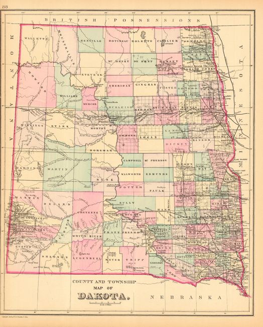
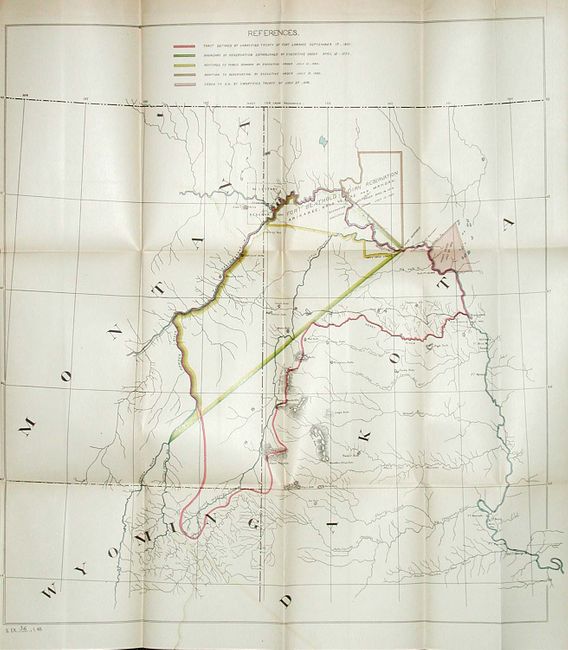
First map is a fine county map that has a brilliant, nearly 3-D impression with original coloring. S.A. Mitchell, published by Wm. Bradley & Bros. (11.6" x 14") 1887. The second map shows the reservation tucked against the border with Montana. U.S. Dept. of Interior (19" x 10") 1884. The map's legend identifies through color and line five boundary changes including the original, unratified, track of the Treaty of Fort Laramie, 1851; boundary as ordered by Executive Order, 1870; land restored to Public Domain, 1880; addition to Reservation by Executive Order, 1880; and land ceded to U.S. by unratified treaty of 1866. Still laid in the original 6-page report, dated 1884.
References:
Condition: A
Former is close trimmed at left, as issued. Latter has a little color offsetting and some tiny fold intersection splits due to thickness of paper, still very good.