Subject: North America
Period: 1845 (circa)
Publication: Illustrated Atlas and Modern History of the World
Color: Hand Color
Size:
9.5 x 13.5 inches
24.1 x 34.3 cm
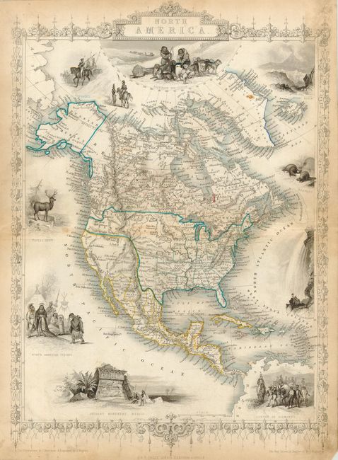
Decorative map surrounded by uncolored steel engraved vignettes drawn by J. Marchant and engraved by J. Rogers. The map is filled with forts and locates many Indian tribes. Texas is shown with a huge panhandle and Arkansas Territory is shown at its largest extent. Mexico controls the Southwest and the Canadian/U.S. boundary in the West reflects Britain's claim to the Columbia river. Alaska is Russian America. Very fancy border and title cartouche. Vignettes include An Ancient (Mayan) Monument in Mexico, Convoy of Diamonds, Falls of Niagara, Beavers, Elk, and North American Indians (after Catlin). One of the last decorative maps produced in the 19th Century.
References:
Condition: B
Good impression with nice, original outline coloring and full, original margins. A little light toning in a couple areas, else very good. Margins with soiling and toning. Vignettes and border uncolored, as issued.