Catalog Archive
Auction 110, Lot 79

"Accurate Charte von Nord-America aus dem besten Quellen", Frentzel, George Friedrich Jonas

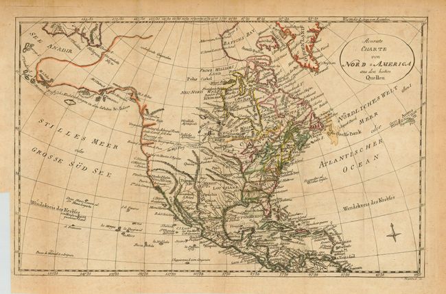
Subject: North America

Period: 1775 (circa)

Publication:

Color: Hand Color

Size:
14.5 x 9.2 inches
36.8 x 23.4 cm
Download High Resolution Image
(or just click on image to launch the Zoom viewer)

An fascinating, and very uncommon, map that extends to include the Caribbean, the Azores and part of Greenland. It's most important feature is the early depiction of Alaska patterned after Muller's epic map of 1750, which was the first to show the Russian discoveries, some noted here. The boundaries of the Southern States extend to the Mississippi River. The Carolinas are not separated. A der West Fluss (River of the West) leads from the Missouri to an entrance discovered by Martin D' Aguilar in 1603 on the West Coast.

References:

Condition: B

Folding, as issued, on thick hand laid paper with watermark. Original outline coloring. Overall light toning or foxing.

Estimate: $250 - $300

Sold for: $180

Closed on 3/2/2005

Archived