Catalog Archive
Auction 110, Lot 680

"Carte de l'Isle de Taiti, par le Lieutenant J. Cook", Cook, James (Capt.)

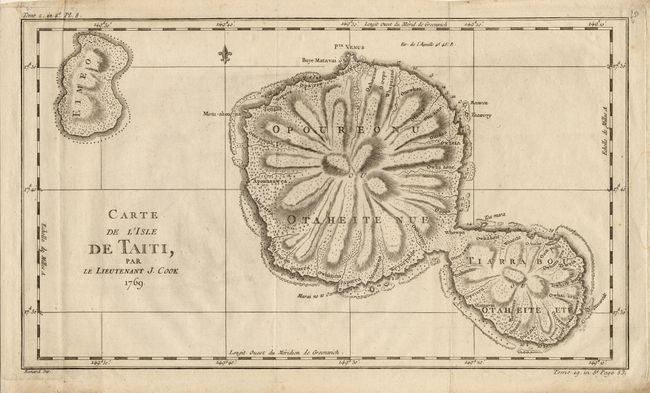
Subject: Pacific - Tahiti

Period: 1769 (dated)

Publication: French Edition of Capt. Cook's Voyages

Color: Black & White

Size:
16 x 9.2 inches
40.6 x 23.4 cm
Download High Resolution Image
(or just click on image to launch the Zoom viewer)

This copper engraved map of the islands of Tahiti is one of the earliest charts of the island. Fully engraved to show its unique mountainous topography and rivers radiating from the centrally located mountain or volcano. Insets of "Baye Matavai dan O-Taiti," "Plan des Havres, situes au cote Nord d'Eimeo" and "Carte des Marquises de Mendoce." Large attractive compass rose. Engraved by Benard.

References:

Condition: A

Good impression on hand laid paper with original margins. A little marginal roughness and soiling at one corner. Folding, as issued.

Estimate: $150 - $200

Sold for: $100

Closed on 3/2/2005

Archived