Catalog Archive
Auction 110, Lot 679

"[Lot of 2] Polynesien und der Grosse Ocean (Ostliches Blatt) [and] Polynesien und der Grosse Ocean (Westliches Blatt)", Stieler, Adolph

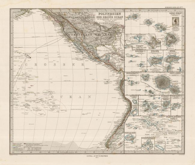
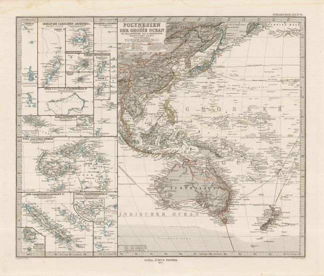
Subject: Pacific Islands

Period: 1875 (dated)

Publication: Stieler's Hand-Atlas

Color: Hand Color

Size:
15.7 x 13 inches
39.9 x 33 cm
Download High Resolution Image
(or just click on image to launch the Zoom viewer)

Pair of maps covering the Pacific Ocean with amazing detail. The Western sheet covers the region to include New Zealand, Australia, Indonesia, Malaysia, Thailand, Japan, the Philippines, Marshall Archipelago, and east to Samoa. Numerous insets include Fiji, Tonga, Guam and much more. The Eastern Sheet shows all of the United States and Mexico, with the Hawaiian, Polynesian, and Marquises Island groups. Many insets provide great detail of islands including the Tahitian, Hawaiian and Galapagos groups. This map shows the Transcontinental Railroad connecting with the ship and steamship routes in the Pacific. Keyboard style borders. A fine pair of matching maps.

References:

Condition: A

Crisp, precise impression. Full margins.

Estimate: $140 - $180

Sold for: $70

Closed on 3/2/2005

Archived