Catalog Archive
Auction 110, Lot 677

"[lot of 2] Kaart van het Eiland Otahiti [with] Matavia Baai te Otahiti [on sheet with] Haven van Ohamaneno te Ulietea [and] Haven van Owharre te Huaheine [and] Haven van Oopoa te Ulietea", Cook, James (Capt.)
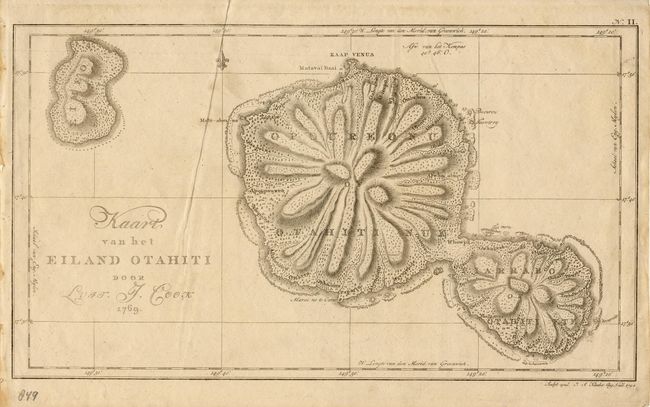
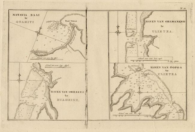
Subject: Polynesia

Period: 1794 (dated)

Publication:

Color: Black & White

Size:
15.5 x 9 inches
39.4 x 22.9 cm
Download High Resolution Image
(or just click on image to launch the Zoom viewer)

Two maps from Dutch editions describing the explorations of Captain James Cook in Polynesia. First (15.5 x 9") engraved by Klauber, dated 1794, is a nice map of the islands of Tahiti. Second, (13.2 x 8.4") anonymous, circa 1795, includes 4 detailed charts on one sheet. These maps show protected bays on the islands of Otahiti (Tahiti), Ulietea, and d'Huaheine.

References:

Condition: B

First with a minor crease and light surface soil. Second very good with a printer's ink flaw near center.

Estimate: $200 - $250

Sold for: $150

Closed on 3/2/2005

Archived