Subject: Western Hemisphere
Period: 1670 (circa)
Publication:
Color: Hand Color
Size:
22.7 x 19.2 inches
57.7 x 48.8 cm
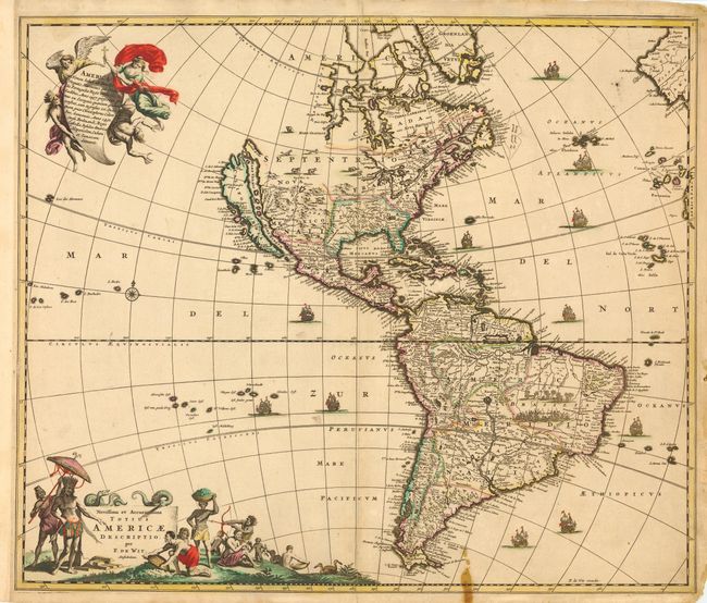
This is the first state of De Wit's map of the Americas. It is a close derivative of Nicolas Visscher's influential map. However, the island of California and the Great Lakes are shown on the Sanson model. In the Southwest, the Rio del Norto flows from a large interior lake and empties into the sea between the mainland and California. In South America, Parime Lacus is prominent and a battle scene and village appear in the Brazilian interior. New Zealand is not shown in the South Pacific. The map is embellished with two large cartouches that were also copied from Visscher. The top cartouche depicts angels struggling with a devil for the soul of a Native American. The pictorial title cartouche contains scenes of gold panning, hunting and a native chief standing beneath an umbrella. Numerous galleons sail the oceans.
References: McLaughlin #49-1; Tooley p. 120 #30; Wheat [TMW] #52.
Condition: B
Generally very good with a fine impression and original color. Small stain at bottom in blank area of map and in border, and some minor repairs in margins.