Subject: Egypt
Period: 1843 (dated)
Publication:
Color: Hand Color
Size:
29.5 x 21.5 inches
74.9 x 54.6 cm
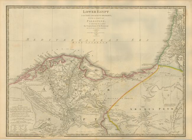
Beautifully engraved map covering the region from Arabs Bay (Plinthinetes Sinus) in the west to the delta of the Nile and into the Holy Land to above Mt. Carmel, and south to well below Memphis to Atsieh, Adhroditopolis, and Ellahoun. Fine detail throughout with scores of villages located and named, numerous roads, trails and camel routes detailed and many named, for example "Derb el Fern - Upper Road belonging to the Haouatat Bedwins." Fully engraved desert to simulate sand. Delineates the Lake of Menzaleh near the mouth of the Nile. Table gives the translation for some common Arabic names. Seven distance scales, decorative keyboard style border. Map by L.S. de la Rochette and published by Wyld.
References:
Condition: B
Crisp, early impression on thick paper with original heavy linen backing. Original outline color. A few minor spots, else very good to fine.