Catalog Archive
Auction 110, Lot 497

"A New Map of Hungary with its Divisions into Gespanchafts or Counties: The Principality of Transylvania, Croatia &c.", Cary, John

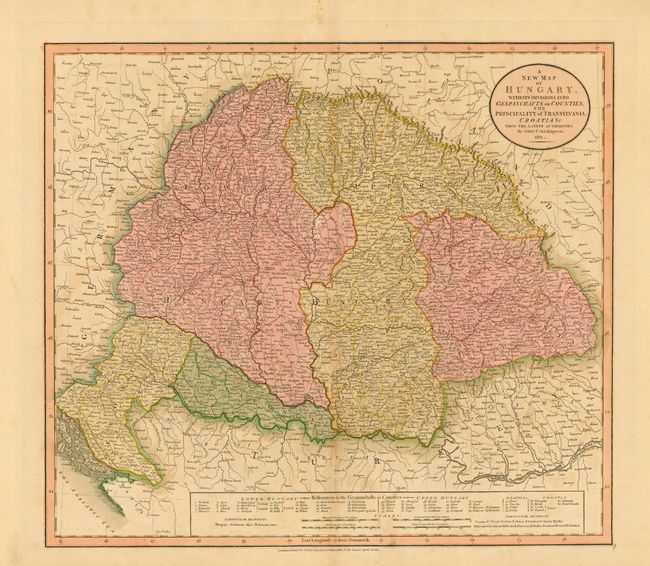
Subject: Southeastern Europe

Period: 1811 (dated)

Publication: New Universal Atlas

Color: Hand Color

Size:
20.2 x 18 inches
51.3 x 45.7 cm
Download High Resolution Image
(or just click on image to launch the Zoom viewer)

A large copper engraved map of Hungary that includes Croatia, Sclavonia, Transylvania and Upper and Lower Hungary. Finely detailed throughout with an added table of data and mileage scales along lower margin. The map is beautifully colored and dense with city and village names. Circular title cartouche at upper right.

References:

Condition: B

Beautiful, early impression with original coloring. Printed on thick paper with full margins. A little light toning in blank areas and two small areas of surface paper loss, else very good to fine.

Estimate: $160 - $200

Unsold

Closed on 3/2/2005

Archived