Catalog Archive
Auction 110, Lot 490

"Mappa Geographica exhibens Electoratum Brandenburgensem, sive Marchiam Veterem, Mediam et Novam, nec non Marchiam Ukeram…", Lotter, Tobias Conrad
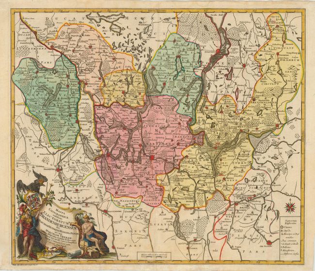
Subject: Germany

Period: 1758 (dated)

Publication:

Color: Hand Color

Size:
22.5 x 19.5 inches
57.2 x 49.5 cm
Download High Resolution Image
(or just click on image to launch the Zoom viewer)

Decorative map of part of Germany, centered on Berlin. The area shown extends from Magdeburg in the west to Driesen in the east, with Stettin and Strasburg in the north, and Cottbus in the south. The fortified cities are boldly shown in red and topographical information is graphically depicted including swamps and forests. Other points of interest include postal roads and monasteries. At lower left is a large cartouche flanked by mythical figures and incorporating the coat of arms and an eagle.

References:

Condition: B

Light damp stains in margins with a couple of small tears into map at bottom, repaired with tissue.

Estimate: $350 - $400

Unsold

Closed on 3/2/2005

Archived