Subject: France
Period: 1587-1656 (dated)
Publication:
Color: Black & White
Size:
19 x 14.7 inches
48.3 x 37.3 cm
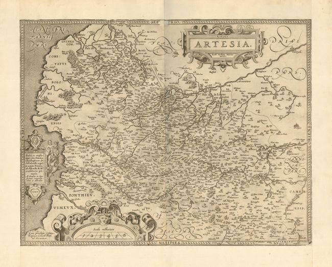
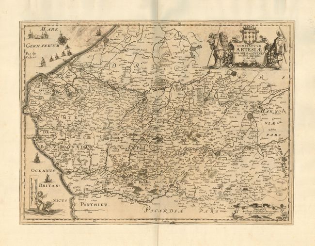
Nice pair of 16-17th Century maps of. The first, by Ortelius, 1587, is a lovely map of the region absolutely filled with details and place names, and decorated with three cartouches, fancy borders and a stippled sea. This map was prepared by Jacob Surhon who made a manuscript map of Artois for which he received 36 Livres from Charles V in 1554. For security reasons the map was not published. Only in 1579, when Antwerp was independent for a short time, did Ortelius publish the map in his atlas. The second map is by Pieter Verbiest, 1656. It is also very detailed with scores of towns and cities including the walled cities of Douay, Arras, Arien, S. Omer, Ardres, and Duynkercke. Richly embellished with sailing ships, soldiers and a coat of arms forming the title cartouche and a mermaid supporting the distance scale.
References: 1) van den Broecke #73.
Condition: B
Both with paper added to margins, likely for inclusion in a composite atlas. First has a little surface soiling, else fine. Second has professionally closed centerfold. Trimmed to neatline and laid on old paper, with three tiny holes, otherwise fine.