Subject: South Pole
Period: 1875 (dated)
Publication: Stieler's Hand-Atlas
Color: Hand Color
Size:
16.2 x 13.2 inches
41.1 x 33.5 cm
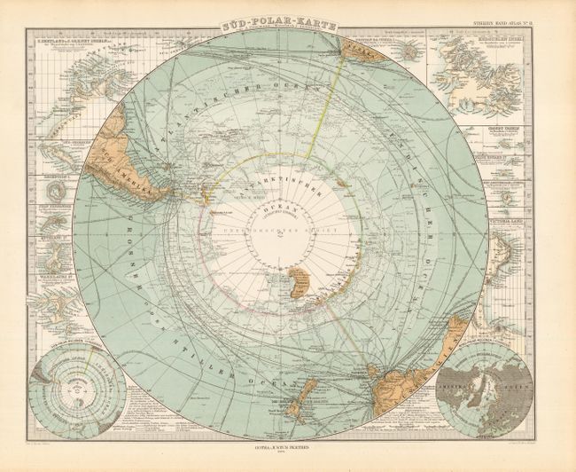
A steel engraved chart filled with finely engraved details. It contains a remarkable amount of information including the tracks of numerous explorers and scores of ship routes with sailing days noted. Known portions of Antarctica are mapped. Around the main hemisphere are 12 inset maps that include two small polar hemispheres and the islands of Juan Fernandez, Deception, Shetland and Orkney, Warekauri, St. Paul, Crozet, Victoria Land, Kerguelen and Tristan da Cunha. Legend identifies the various explorers routes.
References:
Condition: A+
Crisp, bright impression on thick paper with full margins.