Subject: North Pole
Period: 1753 (circa)
Publication:
Color: Hand Color
Size:
12 x 12 inches
30.5 x 30.5 cm
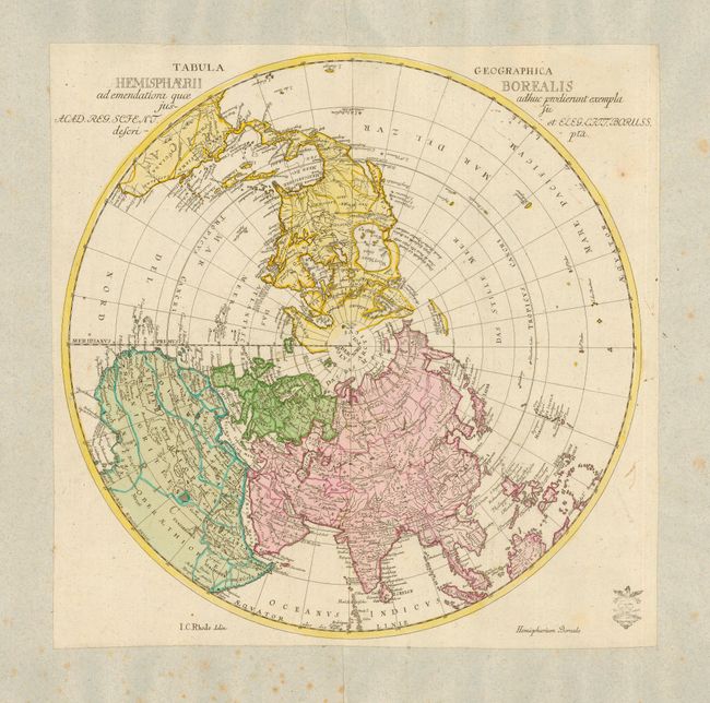
This interesting and uncommon polar map shows the fictitious Mer de L’Ouest prominently with an extensive river system connecting it with the Great Lakes and thus forming a Northwest Passage. Johann Cristoph Rhode [1713-1786] was an active publisher in Berlin during the 1740s and 1750s and is best known for his important French and Indian War maps. This map was prepared for the Royal Prussian Academy of Sciences and was published in Leonhard Euler’s atlas.
References:
Condition: B
Map has been slightly trimmed and pasted onto a large sheet of nineteenth century French paper, probably for inclusion in a composite atlas. Scattered foxing on back sheet, with a few in margins of map and a printer's crease across the Pacific Ocean.