Subject: Arctic
Period: 1720 (circa)
Publication:
Color: Black & White
Size:
22.5 x 13 inches
57.2 x 33 cm
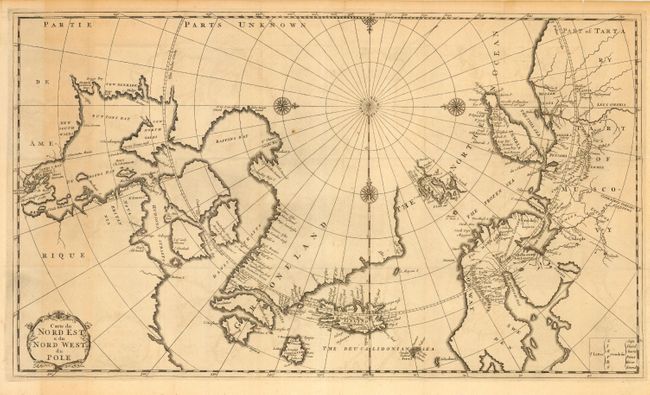
Copper engraved map of the Arctic showing the three-island version of Greenland, based on Sanson, and Nova Zembla as an island. The mythical island of Freesland, with several place names, is shown off the southwest coast of Greenland. This map is derived from Moses Pitt's map of the Arctic that was reduced by Robinson in 1694. First published in his Recueil de Voyages au Nord 1717, this copy in the second state as mentioned by Kershaw probably from Isaac de la Peyrère’s history of Greenland. Two place names in Iceland, Papei and Sneland, also suggest a relation with a map by Pierre Duval that accompanied La Peyrère’s book about Iceland. Embellished with four compass roses and a title cartouche.
References: Kershaw #123.
Condition: B
Crisp impression and good margins. Issued folding. A few tiny rust spots, some toning and light offsetting.