Subject: Scotland
Period: 1689 (dated)
Publication: Great Britain's Coasting Pilot
Color: Hand Color
Size:
22 x 17.4 inches
55.9 x 44.2 cm
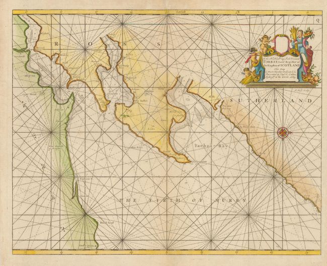
Until Captain Collins published his Coasting Pilot in 1693, British mariners were mainly dependent on outdated charts made by the Dutch. Collins' survey was commissioned by Charles II and was the first systematic survey of British coastal waters and the first marine atlas of British waters engraved and printed in London from original surveys. This map illustrates the Moray Firth in northeastern Scotland with the cities of Inverness and Cromarty. The chart is oriented with west at top by a lovely compass rose. The large cartouche contains a dedication to Lord Viscount Torbat and is embellished with putti and the allegorical female representation of Earth.
References: MCC No. 58, #37.
Condition: B
Two worm tracks and a couple tiny wormholes along centerfold, infilled and repaired with tissue.