Subject: England
Period: 1588 (published)
Publication: Mariners Mirrour
Color: Hand Color
Size:
19.2 x 12.2 inches
48.8 x 31 cm
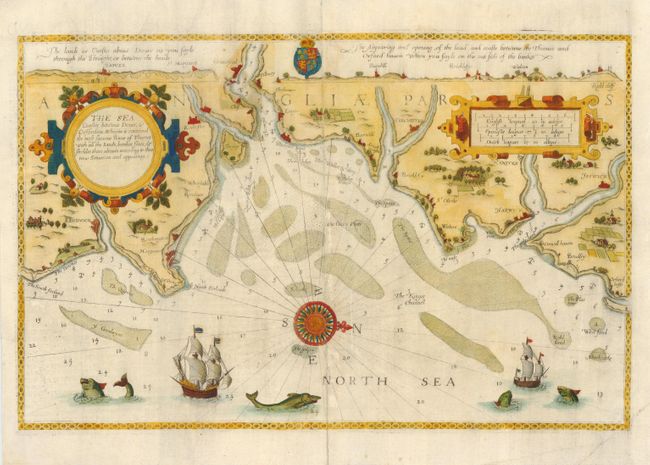
A very early sea chart covering the mouth of the Thames River with a wealth of detail including soundings, sandbars, towns and coastal topography. The map is from the very rare English text edition of the Spieghel der Zeevaerdt, the first detailed atlas of charts covering the coastlines of Europe. It was translated into English by Anthony Ashley, clerk of the Privy Council, who used the Latin edition of 1586 as a model. The charts are renowned for their fine engraving by the best craftsmen of the period including Theodore de Bry and the Doetecum brothers. This map is beautifully embellished with two large strapwork cartouches, a compass rose, coat of arms, sea monsters and ships.
References:
Condition: B
Professionally backed with Japanese tissue to repair centerfold and strength paper where original color has oxidized. Minor abrasions along fold. Color refreshed.