Subject: Britain
Period: 1595 (dated)
Publication: Theatrum Orbis Terrarum
Color: Hand Color
Size:
20 x 14.2 inches
50.8 x 36.1 cm
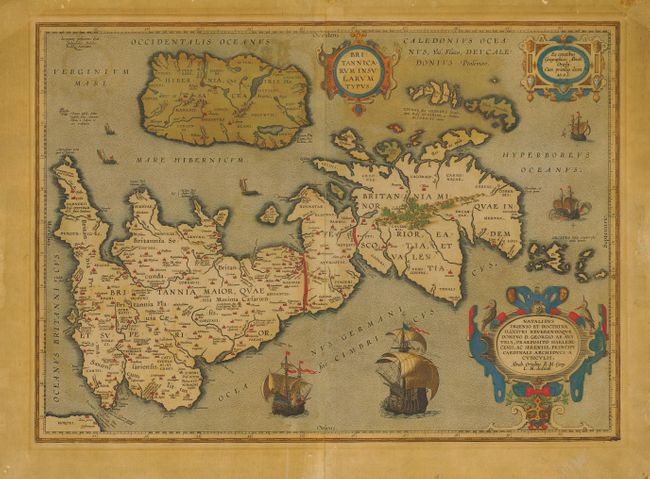
Handsome map of Roman Britain based on information from Mercator's 1564 map of the British Isles, improved by a new outline from Saxton's 1579 map and ancient knowledge from Diodorus, Siculus, Plinius, Appianus, Tacitus, Cæsar and Strabo. The map is filled with ancient place names, Hadrian's Wall, and Wall of Pius (mislabeled Severi Imp. Murus). Richly embellished with three large strapwork cartouches and several sailing vessels.
References: Shirley (BI) #186, plt. 71; Van den Broecke #192.
Condition: B
Toned with strong original color. Map has been professionally backed with Japanese tissue to stabilize areas of oxidation including a couple of cracks.