Subject: Brazil
Period: 1700 (circa)
Publication:
Color: Hand Color
Size:
21 x 16.2 inches
53.3 x 41.1 cm
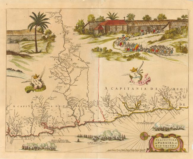
Superb map of the Brazilian coastline including the capitanias of Paraiba and Rio Grande. The map was drawn after actual surveys by Georg Markgraf, Elias Herckmanns and others, and was among the first maps of Brazil based on non-Portuguese data. The map is richly engraved with a huge scene of people and a sugar plantation and three major sea battles are depicted in the sea. Further adorned with coats of arms, compass rose and strapwork title cartouche. The series of four maps of the capitanias of Brazil are unlike any other map in Blaeu's atlases. Blaeu first issued this and its companion maps in 1647 for Caspar van Baele's Rerum per octennium in Brasilia. The maps then appeared in the Atlas Maior beginning in 1662. The plate was acquired after the demise of the Blaeu publishing house by Pierre Mortier, and this issue includes his imprint.
References:
Condition: B
Professional tissue repair on centerfold reinforcing some minor paper weakness.