Subject: Panama
Period: 1906 (dated)
Publication: Isthmian Canal Commission - Panama Canal
Color: Printed Color
Size:
48.7 x 26.5 inches
123.7 x 67.3 cm
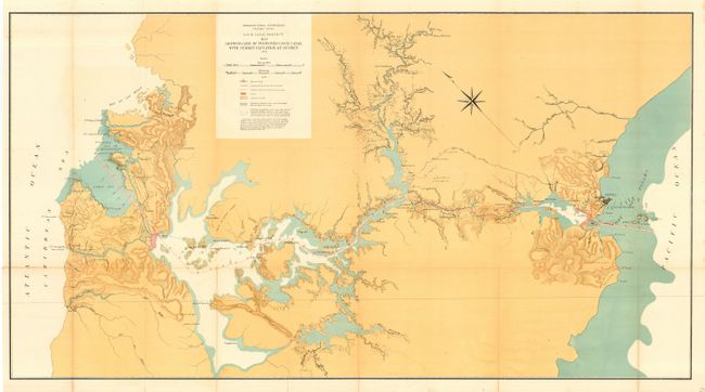
Large and fully colored map that describes the entire canal project. Published in the second full year of construction by the United States, the map is an interesting and early view of the proposed canal as it winds across the isthmus. The map details the course from mile 0 near Colon to the Pacific Ocean offshore from Panama City at mile 50. Remarkably detailed at one inch per mile with strong coloring. Legend gives location of land, Panama Railroad (current and proposed), dams, and more. Notes give background on source of the maps geography and topography. A most historical map on the Panama Canal that is rarely offered for sale.
References:
Condition: A
Issued folded now pressed and backed with archival tissue. Small fold split with archival tape on verso. Hint of toning along two folds, still very good for a map of this size and period.