Subject: Colonial California and Mexico
Period: 1702 (dated)
Publication: Der Neue Welt-Bott
Color: Black & White
Size:
8.7 x 13.5 inches
22.1 x 34.3 cm
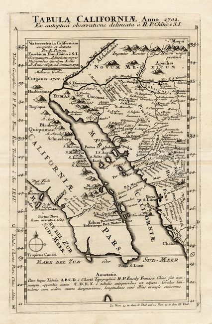
Kino drew the first accurate maps of Sonora, the Gulf of California and Baja California. His observation that the Gulf of California terminated at the mouth of the Colorado River ended the myth of "California as an island" that had persisted for nearly 100 years. This is Father Kino's second map of Lower California disputing the notion that California was an island. Unlike Kino's smaller map of 1701 that was published numerous times, this map is much rarer - appearing only in this rare German Jesuit magazine in 1726. The map shows the entire Baja peninsula and locates the earliest California mission at Loreto and numerous missions in Mexico.
References: Burrus, pl. XII, pp. 47-50; Polk, pp.295-302.
Condition: A+
Very faint toning along fold, still fine with a great impression and wide margins.