Subject: Utah
Period: 1858 (dated)
Publication: Senate Doc 40, 35th Cong., 2nd Sess.
Color: Black & White
Size:
44 x 29.7 inches
111.8 x 75.4 cm
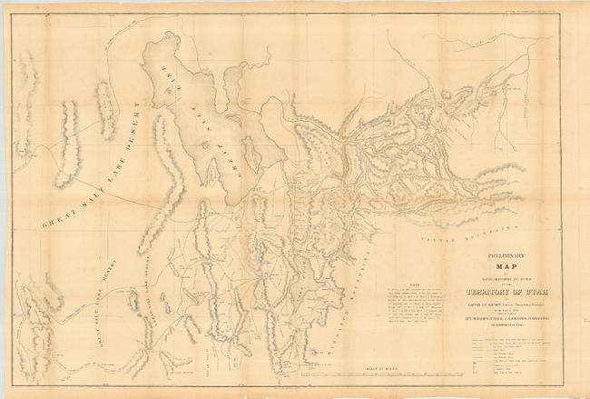
A large, accurate and carefully drawn map detailing that portion of Utah from the Great Salt Lake Desert to Fort Bridger, to above the Great Salt Lake and south to below Goshen and Mt. Nebo. Terrific detail of wagon roads, towns, springs & sinks, military camps as well as topographical information. Tooele is here called Tuilla, and Big & Little Cottonwood creeks are located. Hachure is used to indicate mountains. The map was probably made to facilitate the movements of Gen. Johnson's Army during the Utah campaign as it shows locations of Mormon Fortifications by which the Mormons sought to halt Johnson's movements. An early and historical map of the territory.
References: Wheat (TMW) #998.
Condition: B
Toning on folds, tissue backed with repairs on fold intersections.