Catalog Archive
Auction 110, Lot 227

"Map Showing the Route of the Arkansas Regiment from Shreveport La. to San Antonio de Bexar Texas", U.S. Government
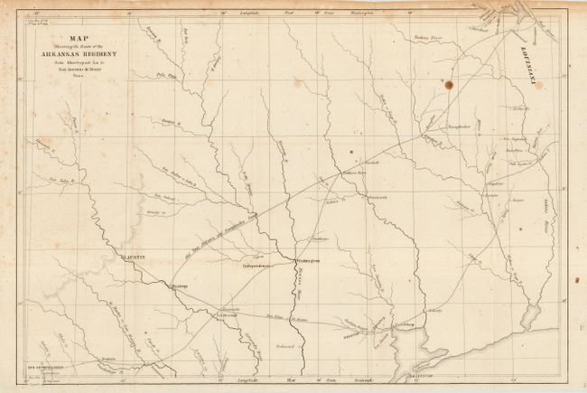
Subject: Texas

Period: 1846-50 (published)

Publication: Sen. Doc 32, 1st Sess. 31st Cong.

Color: Black & White

Size:
17.2 x 11.6 inches
43.7 x 29.5 cm
Download High Resolution Image
(or just click on image to launch the Zoom viewer)

Interesting, historical map covering east-central Texas from the Sabine River to San Antonio. The Old San Antonio and Nacogdoches Road is prominently shown. Several very early settlements shown along the roads. This map was among the maps submitted to Congress to illuminate the U.S. Army's first explorations in Texas. It accompanied Capt. G.W. Hughes "Memoir descriptive of the March of a Division of the US Army under the command of BGen. J.E. Wool from San Antonio in Texas to Saltillo in Mexico."

References:

Condition: B

Folding as issued on sound paper. A few spots in map and toning along top margin and into border.

Estimate: $180 - $220

Sold for: $180

Closed on 3/2/2005

Archived