Subject: Oklahoma
Period: 1893 (dated)
Publication: HR Doc 27, 53rd Cong. 1st Sess.
Color: Black & White
Size:
32.5 x 20 inches
82.6 x 50.8 cm
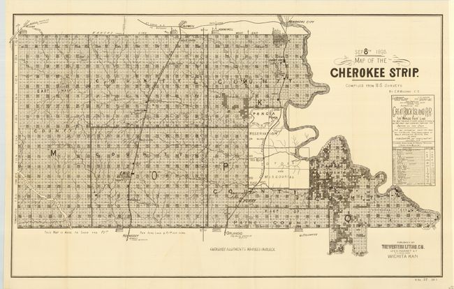
The Cherokee Outlet, about 12,000 square miles in present-day western Oklahoma, was purchased from the Cherokee in 1861. On September 16, 1893 it was opened for settlement with over 100,000 settlers braced on the opening lines. This map details the parcels available at $2.50 and $1.50 per acre. Locates the seven starting booths, plus the railroads, villages and towns, and topographical and watershed information. A remarkable document illustrating one of the greatest land rushes in history. Published by Western Litho. Co., Wichita, Kansas.
References:
Condition: A
Issued folding, now pressed and backed with archival tissue. Beautiful impression. Hint of a small area of toning or staining in blank lower area, else fine.