Subject: New York
Period: 1906 (published)
Publication: The Long Island News Co.
Color: Printed Color
Size:
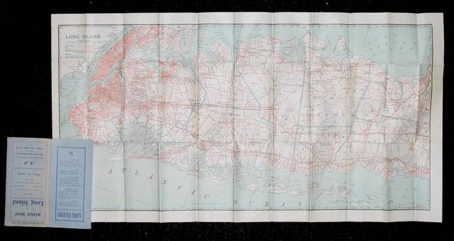
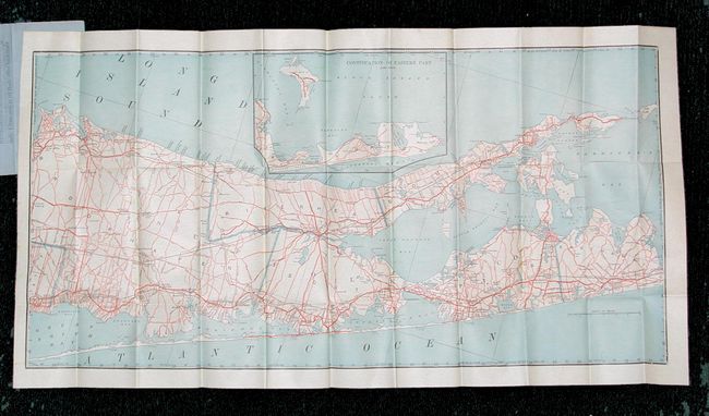
30.4 x 15 inches
77.2 x 38.1 cm
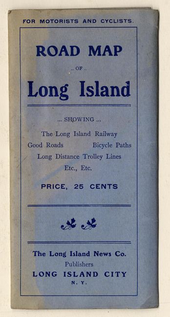
Folding pocket map printed on both sides to show western and eastern Long Island with an inset map of the very tip of the island. The map is very finely printed with a huge amount of detail and hundreds of roads. Extends to give excellent detail of Brooklyn and Manhattan. Map folds into blue paper wrappers titled "For Motorists and Cyclists. Road Map of Long Island Showing The Long Island Railway, Good Roads, Bicycle Paths, Long Distance Trolley Lines." Rear cover of this promotional piece prompts that Long Island is the "ideal location for a summer home or permanent residence... [with] 1,000 miles of perfect macadam and shell roads for Automobiling and Driving." Inside the cover is a list of all cities and towns with population and distance from Long Island City.
References:
Condition: A
Paper wrapper sun faded on a portion of front. Map is fine.