Subject: New York
Period: 1850 (dated)
Publication:
Color: Hand Color
Size:
10.5 x 8 inches
26.7 x 20.3 cm
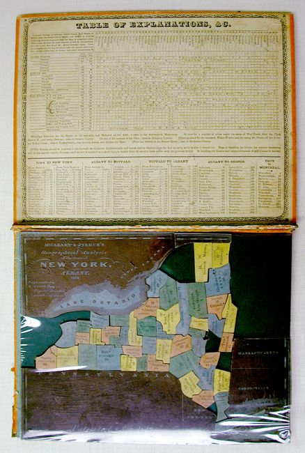
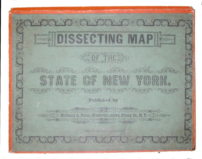
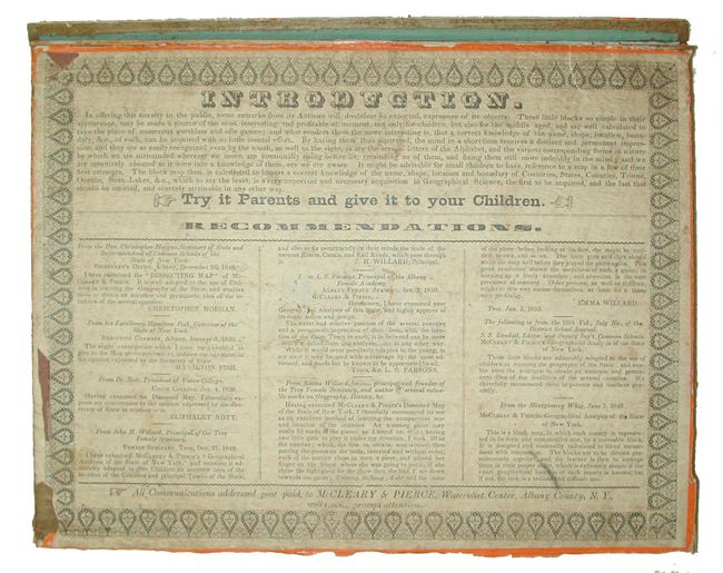
This is the first children's puzzle produced in America. Cover reads "Dissecting Map of the State of New York." Patented Sept. 1849, Albany Co. N.Y. Pieces consist of wood carved county size blocks, some being quite small. Each piece is covered with printed paper giving the county name, county seat and a number. Plus larger side pieces surrounding the puzzle that show the title, and the states of Massachusetts, Connecticut, New Jersey, and Pennsylvania. The side piece representing Vermont is missing. Inside the top cover is a comprehensive Table of Explanations, &c., plus five distance tables giving the total and cumulative mileage from Troy to New York City, from Albany to Buffalo, from Buffalo to Albany, from Albany to Boston, and from Troy to Montreal. Paper cover on bottom features fancy borders, an introduction to the map, along with testimonials from the Governor Emma Willard among others. Published by McCleary & Pierce, Albany. Printed by Cannon Place Steam Press Printing House of Troy, New York. A wonderful piece of American history that is very rarely offered in any condition. We find only two references; the Rumsey example, and another in the collection at Stony Brook University.
References: Rumsey 4086A.
Condition: B
Consists of about 49 pieces, missing about 10. The wooden box is present but with side panels missing, top has separated and is a little worn. The top is covered with paper showing an ornate border and printed title. Some light pencil X's on pieces.