Catalog Archive
Auction 110, Lot 188

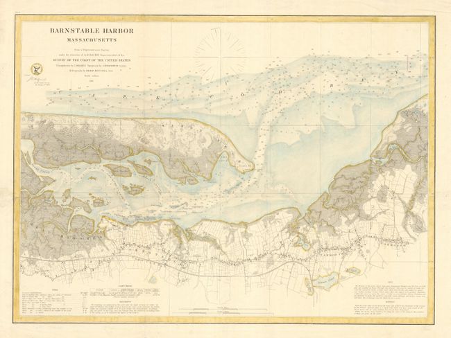
"Barnstable Harbor Massachusetts", U.S. Coast Survey

Subject: Massachusetts

Period: 1861 (dated)

Publication:

Color: Hand Color

Size:
22.2 x 16.2 inches
56.4 x 41.1 cm
Download High Resolution Image
(or just click on image to launch the Zoom viewer)

Chart of the harbor and town of Barnstable, on the Cape Cod Bay side. Locates Sandy Neck and light, the Yarmouth and Cape Cod railroads, and the islands of Huggins, Little and Great Thatcher, and Phillis. Filled with soundings and navigational notes. Compass rose provides magnetic variation.

References:

Condition: A

Later color with a blue wash and yellow outline. Issued folded, now with tissue reinforced folds.

Estimate: $130 - $160

Sold for: $65

Closed on 3/2/2005

Archived