Subject: Kansas
Period: 1866 (dated)
Publication:
Color: Hand Color
Size:
33 x 23.4 inches
83.8 x 59.4 cm
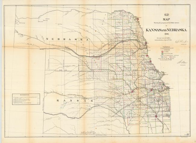
Great early survey map that shows the whole of Kansas and Nebraska with counties delineated and railroad land grants shown. Lincoln and Dawson are the furthest west counties in Nebraska. The railroad information is one of the map's most interesting features with Butterfield's Overland Despatch Route shown west from Fort Ellsworth. The Union Pacific Railroad is shown completed to Morrows Ranche on the Platte River, well beyond Fort Kearney. Locates numerous towns, trust lands, reserves, and military lands. Whitehairs Village, delineated with numerous tipis, is the most prominent Native American village. There are fewer tribal lands noted here than on the 1863 issue. Mineral types are detailed with different colors and include Coal, Lead, Salt Lands, Platina and Marble.
References: Wheat (TMW) #1151.
Condition: B
Original outline color. Issued folding, now pressed and backed with archival tissue. A few folds with light toning and a couple of spots, else very good.