Subject: California
Period: 1870 (dated)
Publication:
Color: Hand Color
Size:
15.2 x 21.5 inches
38.6 x 54.6 cm
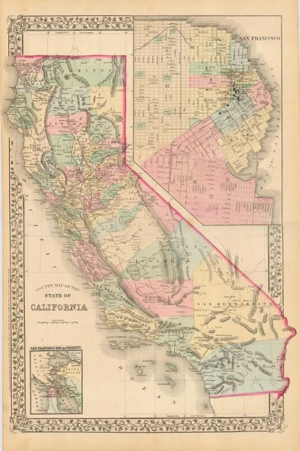
This is the less often seen double-page map of California. The map is a lovely stone engraving with floral borders and much detail throughout. It features a huge (7.5" x 10.5") inset of San Francisco with excellent detail of existing roads and streets. The map details the cities, towns, counties, and railroads of the day. Shows the bay with little of the reclamation we see today. Smaller inset of San Francisco Bay and Vicinity that extends to show all of San Pablo Bay, Vallejo and part of Mare Island, and portions of the counties of Marin, Conta Costa and Alameda. San Bernadino county extends nearly to the Pacific Ocean, only stopped by a sliver of Los Angeles County. No sign of Orange county. Tulare Lake is shown at it's full extent, while there is no sign of the Salton Sea.
References:
Condition: A
Fine impression and nice original color. Centerfold separations repaired with archival tape. A couple small spots that are not distracting.