Subject: California
Period: 1850 (published)
Publication: Senate doc 47, 31st Congress, 1st Sess.
Color: Black & White
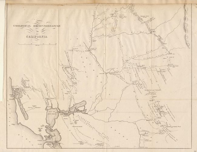
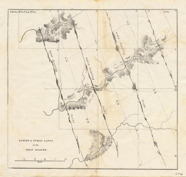
Two important early maps of the Gold Rush regions. The first map (14.8 x 11.6") details the month-long expedition from San Francisco to Benecia and on to the Yuba diggings, hence through the Gold Regions, the Calaveras River and returning via Livermore's Ranch to Martinez. A second route is shown to Bodega Bay and the north coast. Coloma is noted as the place gold was first found. Gives the dates on which various localities were visited, the geological conditions, and the points where gold was being dug. Locates Sacramento, Stockton, the Wagon Road from Suter's to Dater's, and the Emigrant's Road to the Salt Lake. The second chart (8.4 x 7.8") details the Gold-bearing Veins without attribution to it's location.
References: Wheat (Gold) #179.
Condition: B
Both issued folding. First backed with archival tissue. Top margin close trimmed, into neatline at top, as issued. Top paper margin added for support, else very good. Second with light foxing.