Subject: United States - Southwestern
Period: 1860 (dated)
Publication: Sen Ex. Doc. No. 1, 2nd Sess. 30th Congress
Color: Black & White
Size:
32.5 x 23 inches
82.6 x 58.4 cm
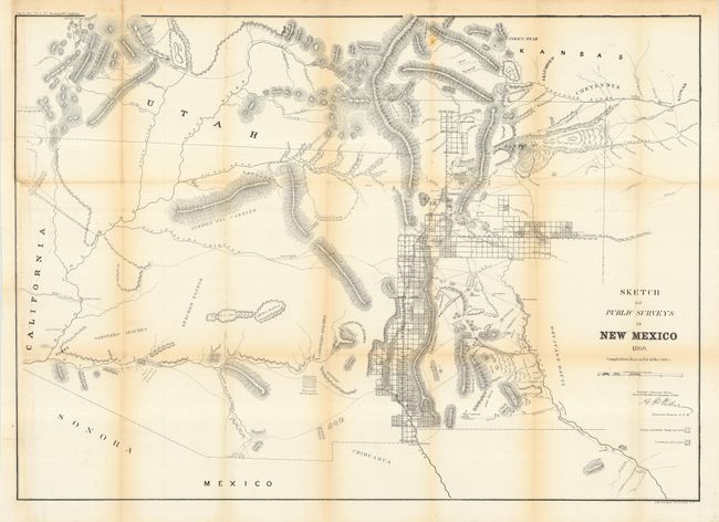
Early, large-scale, territorial map by the Surveyor Generals Office, Santa Fe New Mexico. Shows the territory prior to Colorado annexing the San Luis Valley region. Extends to the Colorado River and north to Salt Lake City. Locates numerous Indian villages and reservations, extent of surveys completed including Pueblo claims and subdivided townships. Limited and mostly inaccurate detail in present day Arizona. Shows the Santa Fe Trail (wagon road to Ft. Leavenworth), and the wagon road to San Antonio. Good detail of mountains in hachure, springs, watershed and mineral locations. An early version of an increasingly difficult map to obtain.
References: Phillips (A) #1388-22; cf. Wheat (TMW) #1153.
Condition: B
Issued folding, now pressed and backed with archival tissue. Left margin added in area of binding trim with border in facsimile. Toned along folds.