Subject: United States - Pacific Coast
Period: 1852 (dated)
Publication:
Color: Black & White
Size:
22.5 x 21.6 inches
57.2 x 54.9 cm
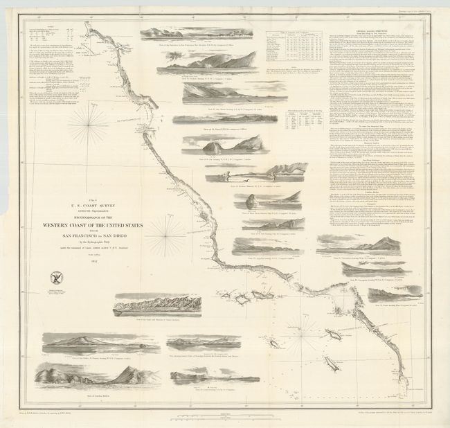
Terrific chart from the first official scientific reconnaissance of the Pacific coast. Covers the region from the Mexican boundary to Point Reyes. Outlines the coastal littoral, shows dangerous reefs and shoals, gives offshore bathymetric soundings, plus general and specific harbor sailing instructions. The most impressive feature is the 17 views of entrances and promontories along this rugged coastline, among them Santa Barbara, Catalina Harbor, and the entrance to San Francisco Bay. One of the most desirable Coast Survey charts in beautiful condition.
References: Heckrotte & Sweetkind #33; Schwartz & Ehrenberg, plt. #174.
Condition: A
A very clean and bright example. Folding, as issued. One short split, repaired with archival tape, just into map, else fine.