Catalog Archive
Auction 110, Lot 145

"Gray's New Map of North Carolina and South Carolina", Gray, Ormando Willis & Son

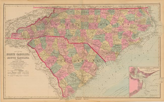
Subject: North Carolina and South Carolina

Period: 1881 (published)

Publication: The National Atlas

Color: Hand Color

Size:
26.5 x 16 inches
67.3 x 40.6 cm
Download High Resolution Image
(or just click on image to launch the Zoom viewer)

Very nicely detailed stone engraved map. Political divisions are shown by lovely pastel coloring. Much information throughout including counties, cities and towns, railroads, mountains and rivers, coastal details including soundings and isodepth lines in fathoms. Large inset of "Charleston Harbor and its Approaches" details the town, harbor and the Ashley and Cooper rivers. Blank verso.

References:

Condition: B

Nice impression and coloring with original margins. Light tide mark in top and bottom margins, just into map border, and patch of paper pulled up on neatline, else fine.

Estimate: $100 - $140

Sold for: $75

Closed on 3/2/2005

Archived