Subject: Colonial Mid Atlantic
Period: 1665 (circa)
Publication:
Color: Hand Color
Size:
19.2 x 15 inches
48.8 x 38.1 cm
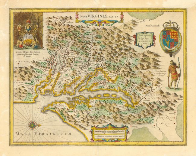
Henricus Hondius' version of Capt. John Smith's important map of 1612, drawn from his brother's earlier map of 1618. After the death of Jodocus in 1629, his widow sold a number of plates to Blaeu. Angry at the sale to a competitor, Henricus and Joannes Jansson engaged engravers to cut new plates, which were largely based on Jodocus' work. In the upper left corner is an engraving of the great Indian chief Powhatan seated on his throne and surrounded by his subjects. A Susquehanna chief, facing in toward Chesapeake Bay, is depicted on the right under a coat of arms. Blank verso.
References: Burden #228.
Condition: A
Expert repairs of short fold separations, infilling of a few wormholes and paper restoration (leaf-casted) on upper right margin (including expert facsimile of neatline). These repairs are all extremely well executed and now near invisible.