Subject: Colonial New England
Period: 1776 (dated)
Publication:
Color: Hand Color
Size:
21 x 25 inches
53.3 x 63.5 cm
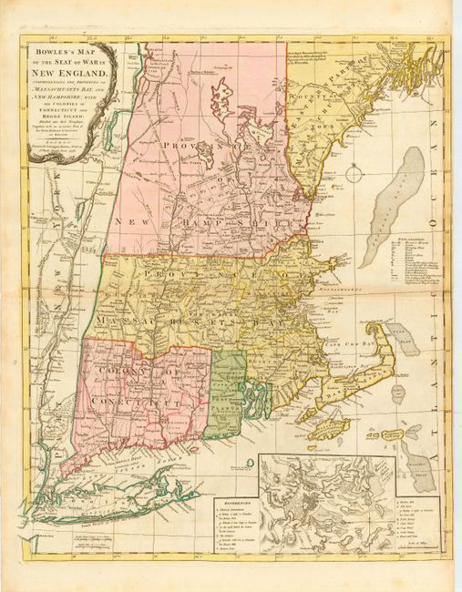
This great Revolutionary War period map is based on Thomas Jefferys' four-sheet map of 1755 and was originally published by Bowles in 1765 with a different title. The map has a long history and underwent several revisions and title changes; this one resulting from increased interest in the region at the outbreak of the war. The map covers from Penobscot Bay to Long Island and inland to the Hudson River. It illustrates several boundary disputes between the New England colonies and shows in great detail the cities, roads, trails, forts, rivers, waterfalls, portages, landmarks, and land grants. Interesting notations in the Province of New Hampshire include The Kings Woods, Wilderness Lands of the Crown not yet appropriated, and A double Line of Towns for a Frontier against the Indians. A large inset of Boston Harbor, a decorative title cartouche and extensive keys and explanations make this an essential map for New England or Revolutionary War period collectors.
References: Fite & Freeman #60; McCorkle #776-8; Sellers & Van Ee #811; Stevens & Tree #32-c.
Condition: A
Overall very good with slight toning and one tiny wormhole along centerfold. Right margin trimmed nearly to neatline, apparently as issued.