Subject: Colonial New England
Period: 1741 (circa)
Publication:
Color: Hand Color
Size:
21 x 23.5 inches
53.3 x 59.7 cm
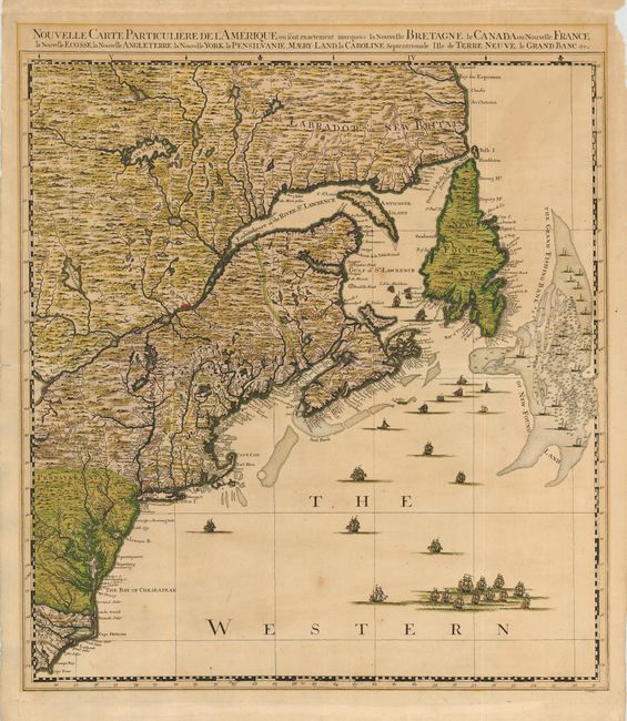
This is the northeast sheet of Covens & Mortier's edition of Popple's monumental map of North America. Popple based his map on firsthand information gathered over several years at the Board of Trade and Plantations. The map, first issued in London on twenty sheets in 1733, was the first large-scale British map to provide an overall view of the eastern half of North America. As tensions grew between the colonial powers, the map became immensely influential throughout Europe and was copied by several cartographers. This map covers the region from Labrador to Cape Fear, North Carolina, and inland to the eastern shore of Lake Ontario. The map is filled with incredible detail including the important Grand Fishing Bank of New-Foundland. The sea is filled with a myriad of different ships and fishing boats. The map stands on its own with complete borders with title above top border.
References: McCorkle #741-4.
Condition: B
Superb dark impression and original color. Evenly toned with a couple of light spots in map. Paper edge chipping and mat burn in blank margins.