Subject: Colonial New England
Period: 1671 (published)
Publication: Die Nieuwe en Onbekende Weereld
Color: Hand Color
Size:
14.5 x 11.5 inches
36.8 x 29.2 cm
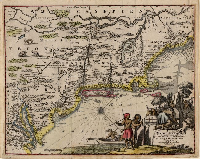
A finely engraved map of New England based on the influential Jansson-Visscher series. Geographically the map follows Jansson including the placement of nearly every European settlement along the coastline and rivers. The nomenclature reflects the Treaty of Breda (1667), in which the Dutch swapped New York for the island of Run in the East Indies, the only source of nutmeg. New place names include Nova Albania, Nieu-Jarsey, Jorck shire and Iamaica. The land is fully engraved to show forests and mountains, and tiny animals fill the interior. The large pictorial title cartouche shows Native Americans in a variety of occupations.
References: Campbell (MCC-24) #21; McCorkle #671.1.
Condition: B
Narrow side margins (as is usual for this map) have been extended to better accommodate framing. Slight mat burn in blank margin and damp stain at bottom, just entering map.