Subject: United States - Eastern
Period: 1829 (dated)
Publication:
Color: Black & White
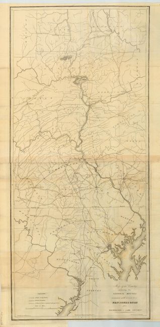
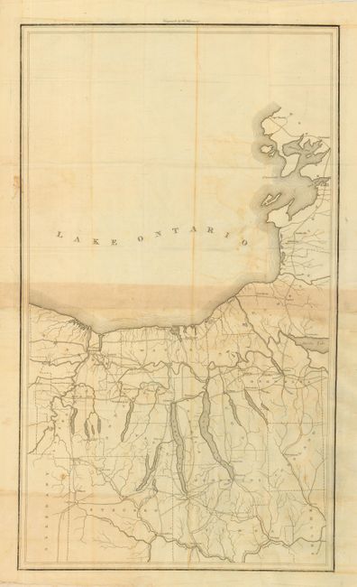
A set of early maps that reflect the federal government's early concern for providing a viable transportation system. The detailed and interesting maps were based on a map by Col. Stephen H. Long, compiled by F. Harrison, Jr., drawn by A.J. Stansbury, and engraved on copper by W. Harrison. Stansbury later commanded an important exploration in the Great Salt Lake Basin that permanently established much topography and many of the place names of northwestern Utah. The first sheet covers an 80-mile section from just below Washington D.C. to Athens, PA, on a scale of five miles to the inch. The second sheet shows the road system north of the Susquehanna River to Lake Ontario. The maps are filled with great detail of country roads, turnpikes, towns and even locates taverns and stores. Two maps, each printed on 2-sheets. First with title is 17 x 37.8", second untitled is 17 x 28.5".
References:
Condition: B
Issued folding on fine banknote paper, now pressed. Occasional light scattered foxing or offsetting.