Catalog Archive
Auction 110, Lot 123

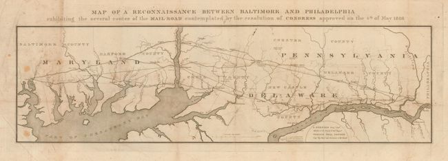
"Map of a Reconnaissance Between Baltimore and Philadelphia exhibiting the several routes of the Mail Road contemplated by the resolution of Congress approved on the 4th of May 1826", U.S. Corps of Engineers

Subject: United States - Eastern

Period: 1826 (dated)

Publication: HR Doc #94, 19th Cong., 2nd Session

Color: Black & White

Size:
31 x 10 inches
78.7 x 25.4 cm
Download High Resolution Image
(or just click on image to launch the Zoom viewer)

A boldly engraved, early and fascinating map that was issued by S. Bernard, Brigr. Genl. and William Tell Poussin, Capt. Top. Engrs, both on the Board of Internal Improvement. The map provides a detailed picture of a strip of land 27 miles wide between the Baltimore and Philadelphia, on a scale of three miles to the inch. Filled with historical details including locating a copper factory, forts, ferries, mills, and more. Some roads are named and all are identified as projected, traveled or turnpikes.

References: Claussen & Friis #7.

Condition: B

Issued folding, now pressed and backed with archival tissue. A few foxing spots at left and some surface soil. Two small areas of puncture, closed by the backing.

Estimate: $240 - $275

Sold for: $180

Closed on 3/2/2005

Archived