Catalog Archive
Auction 110, Lot 113

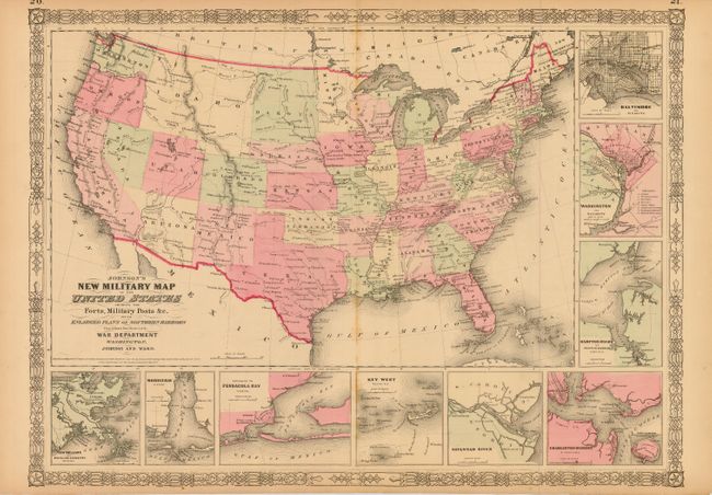
"Johnson's New Military Map of the United States Showing the Forts, Military Posts &c. all the Military Divisions with Enlarged Plans of Southern Harbors…", Johnson & Ward

Subject: United States

Period: 1861 (dated)

Publication: Illustrated Family Atlas of the World

Color: Hand Color

Size:
23.5 x 17 inches
59.7 x 43.2 cm
Download High Resolution Image
(or just click on image to launch the Zoom viewer)

This is the more desirable issue of this map, with the state and territory borders instead of the Military Districts. The large western territories include Dakota, Idaho (incorporating present-day Montana and Wyoming), a narrow Nevada with Arizona including the region containing Las Vegas. Hundreds of military forts are located. The map includes nine inset plans of the major southern harbors and is surrounded by a decorative border. Copyright date 1861, but published circa 1863.

References:

Condition: B

Minor foxing along centerfold and some minor marginal tears repaired with archival tape.

Estimate: $200 - $250

Sold for: $80

Closed on 3/2/2005

Archived