Subject: Colonial Canada and United States
Period: 1755 (dated)
Publication: Atlas methodique
Color: Hand Color
Size:
22.7 x 16.2 inches
57.7 x 41.1 cm
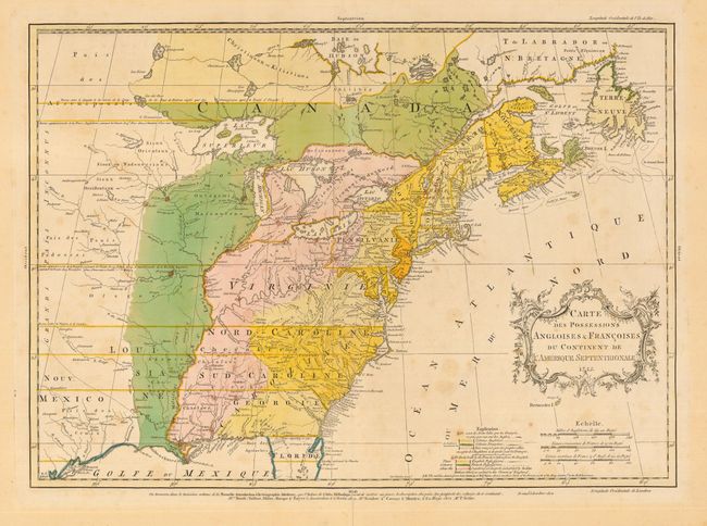
This fascinating map is one of the best maps of the colonies on the eve of the French and Indian War. Mr. Palairet was the Agent to the States-General in London. In 1755 he published his map with a pamphlet "A Concise Description of the English and French Possessions in North-America." The important map was also published in atlas format in London, Amsterdam, Berlin and The Hague, also in 1755. The map was beautifully engraved by Thomas Kitchen and intricately colored to show the disputed lands, forts, roads, and the extent of settlement in the region. The original coloring shows the British colonies in yellow, the French colonies in green, the Countries in dispute in pink, and the chain of forts being built by the French to encircle the British colonies highlighted in red. Embellished with a delicately engraved title cartouche. This is the first state, without Palairet's name in the cartouche, dated 1755.
References: McCorkle #755.22; Stevens & Tree #18; cf. Sellers and Van Ee #56.
Condition: B
Nice impression and original color. Bit of light foxing and separation on centerfold in margin, just into text below neatline, with archival tape on verso.