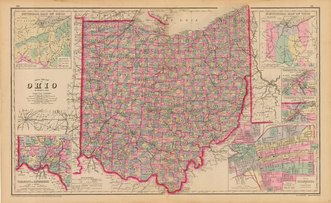
Subject: Ohio
Period: 1881 (published)
Publication: The National Atlas
Color: Hand Color
Size:
26 x 15.8 inches
66 x 40.1 cm
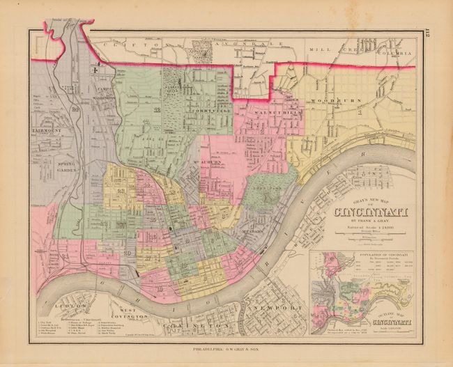
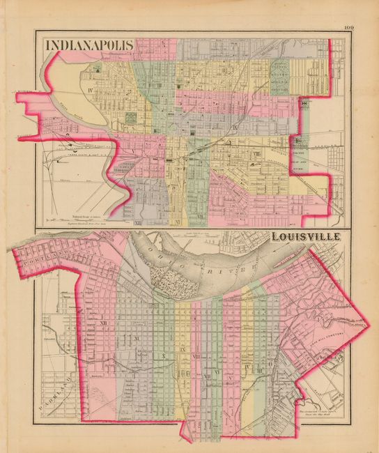
Terrific double-page map that is filled with information including numerous named railroads, cities, towns, watershed, forts, springs, and more. Six insets include city plans of Cleveland, Columbus, Toledo, Cincinnati, plus historical and physical thematic maps. Copyright date 1877, but published in 1881. A most handsome and desirable map of the state that shouldn't be confused with the more common single sheet map. Three city plans on verso: Cincinnati, Louisville and Indianapolis.
References:
Condition: A
Very lovely pastel coloring in a wider pallet than traditionally used by Gray. Crisp, dark impression with full margins. Short centerfold splits, closed on verso with archival tape. One marginal tear, also closed on verso.